Grindavík (Grindavíkurbær)
Grindavík is a fishing town on the Southern Peninsula of Iceland not far from the tuya Þorbjörn.
It is one of the few cities with a harbour on this coast. Most of the inhabitants work in the fishing industry. The Blue Lagoon, Grindavík's premiere attraction, is located 3 mi from the town centre.
Landnáma or The Book of Settlements mentions that around 934, two Viking settlers, Molda-Gnúpur Hrólfsson and Þórir Haustmyrkur Vígbjóðsson, arrived in the Reykjanes area. Þórir settled in Selvogur and Krísuvík and Molda-Gnúpur in Grindavík.
The sons of Moldar-Gnúpur established three settlements; Þórkötlustaðahverfi, Járngerðarstaðarhverfi and Staðarhverfi. The modern version of Grindavík is situated mainly in what was Járngerðarstaðarhverfi.
In June 1627 Grindavík was raided by Barbary Pirates in an event known as the Turkish Abductions. Twelve Icelanders and three Danes, along with two vessels were taken, and with captives taken from other Icelandic settlements, transported into slavery in Algiers.
The origins of the municipality can be traced to Einar Einarsson's decision to move there to build and run a shop in 1897. During that time the population was only around 360. Fishing had for centuries been a crucial element in the survival of Grindavík's population, but fishing trips were often dangerous. Men were frequently lost at sea and the catch not always stable. However, when a safer access point to land was created at Hópið in 1939, fishing conditions changed dramatically. From 1950 serious development in the fishing industry had begun to take place. Grindavík was declared a municipality in 1974.
Map - Grindavík (Grindavíkurbær)
Map
Country - Iceland
 |
 |
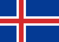
| Flag of Iceland | |
According to the ancient manuscript Landnámabók, the settlement of Iceland began in 874 AD when the Norwegian chieftain Ingólfr Arnarson became the first permanent settler on the island. In the following centuries, Norwegians, and to a lesser extent other Scandinavians, immigrated to Iceland, bringing with them thralls (i.e., slaves or serfs) of Gaelic origin.
Currency / Language
| ISO | Currency | Symbol | Significant figures |
|---|---|---|---|
| ISK | Icelandic króna | kr | 0 |
| ISO | Language |
|---|---|
| DA | Danish language |
| EN | English language |
| DE | German language |
| IS | Icelandic language |
| NO | Norwegian language |
| SV | Swedish language |


